La Jolla Marine Preserve • Tide Pools (“Dike Rock”-Scripps Pier) • PROJECT 4: Geology of La Jolla Marine Preserve

Geology of Dike Rock Tide Pools (North of Scripps Pier)

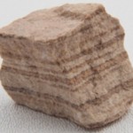
“This tidepool area is interesting for several reasons. First, the geology is unique. Most of the rocks in the coastal areas of Southern California represent ancient beach deposits and are largely sandstones and siltstones. The layering is obvious in the cliffs on either side of the tide pool. These rocks are about 40 to 50 million years old.
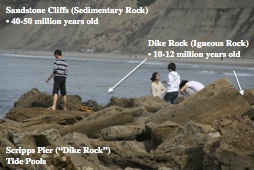
Geology Cliffs-Dike of La Jolla, Dike Rock Tide Pools

“But if you look carefully at the main rock bench that extends out into the ocean and forms the foundation for the tide pools, you’ll see that it is not the same rock that makes up the cliffs . It is darker and harder, and looks similar to the lava rock common on volcanic islands. This vertical outcrop, or “Dike,” was formed from hot, molten rockthat forced its way up through a crack in the layered beach rocks of the cliffs about 10 to 12 millions years ago (Miocene Epoch). This geologic feature is called a dike, hence the name “Dike Rock,” one of the most prominent features of these tide pools.”

What are the Three Types of Rock and How is Each Created (Rock Cycle)?

Igneous (from Latin igneus: “fire”): rocks formed from lava or magma (underground molten rock) Continue reading →

Independent Reading & Research • Chapter 9: Introduction to the Biosphere

DRAFT 8th science grading pie-independent reading

Draft Pie–Add 20% : Matter-Energy Review 7th Grade Atomic Theory + Lab Projects Electro-Magnetic Energy with Extensions: Electronics, Measuring/Math, Life-on-Earth Connections

Pass a Science Independent Reading Pie Exam on Chapter 9 from
FUNDAMENTALS OF PHYSICAL GEOGRAPHY (2nd Edit)

via Chapter 9: Introduction to the Biosphere.

Independent Reading|Research Project • Geography : Physical Geography

What is physical Geography?
Physical Geography is a sub-discipline of two much larger fields of study – Geography and Earth Sciences. The main purpose of Physical Geography is to explain the spatial characteristics of the various natural phenomena associated with the Earth’s hydrosphere, biosphere, atmosphere, and lithosphere.

Geography Chapters

via Geography : Physical Geography.

BBC Nature – History of life on Earth

Jump to:

  • Geological timeline | Geological time periods | Big Five mass extinction events |
  • Mass extinction theories | Ancient Earth habitats
  • Geological timeline

History of life on Earth

Pangea supercontinent from space, as it may have looked 300 million years ago.Pangea supercontinent from space, as it may have looked 300 million years ago.

The Earth is a little over 4.5 billion years old, its oldest materials being 4.3 billion-year-old zircon crystals. Its earliest times were geologically violent, and it suffered constant bombardment from meteorites. When this ended, the Earth cooled and its surface solidified to a crust – the first solid rocks. There were no continents as yet, just a global ocean peppered with small islands. Erosion, sedimentation and volcanic activity – possibly assisted by more meteor impacts – eventually created small proto-continents which grew until they reached roughly their current size 2.5 billion years ago. The continents have since repeatedly collided and been torn apart, so maps of Earth in the distant past are quite different to today’s.

The history of life on Earth began about 3.8 billion years ago, initially with single-celled prokaryotic cells, such as bacteria. Multicellular life evolved over a billion years later and it’s only in the last 570 million years that the kind of life forms we are familiar with began to evolve, starting with arthropods, followed by fish 530 million years ago (Ma), land plants 475Ma and forests 385Ma. Mammals didn’t evolve until 200Ma and our own species, Homo sapiens, only 200,000 years ago. So humans have been around for a mere 0.004% of the Earth’s history.

Jump to:Geological timeline | Geological time periods |Big Five mass extinction events |
Mass extinction theories | Ancient Earth habitats

Geological timeline

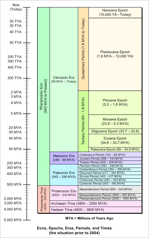
During its dramatic 4.5 billion year history, Earth has gone through a series of major geological and biological changes. The timescale below highlights a number of notable prehistoric events and the geological periods in which they occurred. As things didn’t get interesting from a biological perspective until around 570 million years ago, we’ve included a couple of zoomed in timelines to show the detail of more recent evolutionary history. Show text only timeline

Geological time periods

Continue reading →

Watershed Survey Question 1: Laguna Mountains

San Diego Laguna MountainsLaguna Mountains

This article is about the mountain range in San Diego County, California. For the mountain range in southwest Arizona, see Laguna Mountains (Arizona). For the recreation area in San Benito County, California, see Laguna Mountain Recreation Area.
Laguna Mountains
SoCal Coast.jpg

Laguna Mountains, south of Palomar Mountain and
Elsinore Fault
Highest point
Peak Cuyapaipe Mountain
Elevation 1,944 m (6,378 ft)
Coordinates 32°50′21″N116°24′01″W


Geography
Laguna Mountains is located in California

Laguna Mountains

Location of Laguna Mountains in California [1]

Country United States
State California
District San Diego County
Range coordinates 32°48′30″N116°26′57″W

Coordinates: 32°48′30″N 116°26′57″W


Topo map USGS Mount Laguna

The Laguna Mountains are a section of the Peninsular Ranges in eastern San Diego County, California. The mountains run in a northwest/southeast alignment for approximately 20 miles (32 km).

The Laguna Mountains are bordered by

the Cuyamaca Mountains area on the west and

the Colorado Desert on the east, where the mountains form a steep escarpment along the Laguna Salada Fault.

To the north the Laguna Mountains are bounded by the Elsinore Fault Zone and to the south by Cameron Valley and Thing Valley.

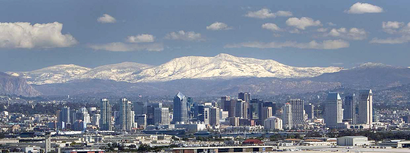
The highest point is Cuyapaipe Mountain at 6,378 feet (1,944 m). The mountains are largely contained within the Cleveland National Forest. Snow falls on the highest peaks several times a year. Mount Laguna is a village in the Laguna Mountains with a population of about 80.

via Laguna Mountains – Wikipedia, the free encyclopedia.

Watershed Survey Question 1: Santa Ana Mountains – Ending in Northern San Diego County

Santa Ana Mountains

From Wikipedia, the free encyclopedia
Santa Ana Mountains
Santa Ana Mountains in Snow.jpg

(2008)
Highest point
Peak Santiago Peak
Elevation 5,689 ft (1,734 m)
Coordinates 33°42′38″N 117°32′03″W

Coordinates: 33°42′38″N 117°32′03″W

Dimensions
Length 61 mi (98 km)
Area 2,104 sq mi (5,450 km2)
Geography
Wpdms shdrlfi020l santa ana mountains.jpg
Country United States
State California
Counties Orange, Riverside and San Diego
Geology
Period Triassic-Jurassic [1][2]
Type of rock metasedimentary[1]

The Santa Ana Mountains are a short peninsular mountain range along the coast of Southern California in the United States. They extend for approximately 61 miles (98 km) southeast of the Los Angeles Basin largely along the border between Orange and Riverside counties.

Geography and climate[edit]

via Santa Ana Mountains – Wikipedia, the free encyclopedia.